
The Geospatial Operations unit provides a variety of CAD services utilizing AutoCad Infrastructure Design Suite and PowerGEOPAK/Microstation. This diversity in software allows us to create drawings from simple site sketches to complete Department of Transportation (DOT) highway design sheet sets. We also incorporate, analyze, and manipulate various GPS data to accurately represent features and location data within our drawings. The Braun Intertec CAD group combines many years of experience with the latest in software tools to efficiently and effectively produce a vast array of two- and three-dimensional outputs.
Our CAD Services Include:
• Site sketches
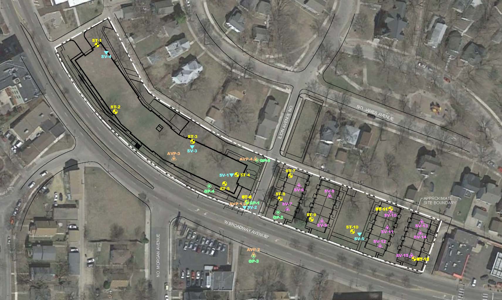
• Soil boring, test pit and sampling location maps
• Groundwater contouring and analysis
• Chemical contamination maps
• Geologic and environmental cross sections maps
• LSI map series
• Corridor map series
• HMA sample sketches
• Cut/fill analysis
• Chemical contamination maps
• Excavation observation maps